One Drive in a Million: A Mile-by-Mile guide to Southwest Colorado's San Juan Skyway and Million Dollar Highway
One Drive
In a Million
A mile-by-mile guide to Southwest
Colorado’s Million Dollar Highway and
the San Juan Skyway
Branson Reynolds
One Drive
in a Million
A mile-by-mile guide to Southwest
Colorado’s Million Dollar Highway and
the San Juan Skyway
Branson Reynolds
One Drive in a Million
Text and Photographs Copyright: Branson Reynolds, 2016
All Rights Reserved
No part of this book may be reproduced or transmitted in any form or by any means, electronic or mechanical, including photocopying, recording or by any informational storage or retrieval system except by a reviewer who may quote brief passages in a review to be printed in a magazine or newspaper without written permission from the publisher.
ISBN-13: 978-1-4566-2708-9
Book Design by Branson Reynolds
Published in eBook format by eBookIt.com
One Drive in a Million
A mile-by-mile guide to Southwest Colorado’s Million Dollar Highway and the San Juan Skyway
Branson Reynolds
Introduction
Scenic view of San Juans
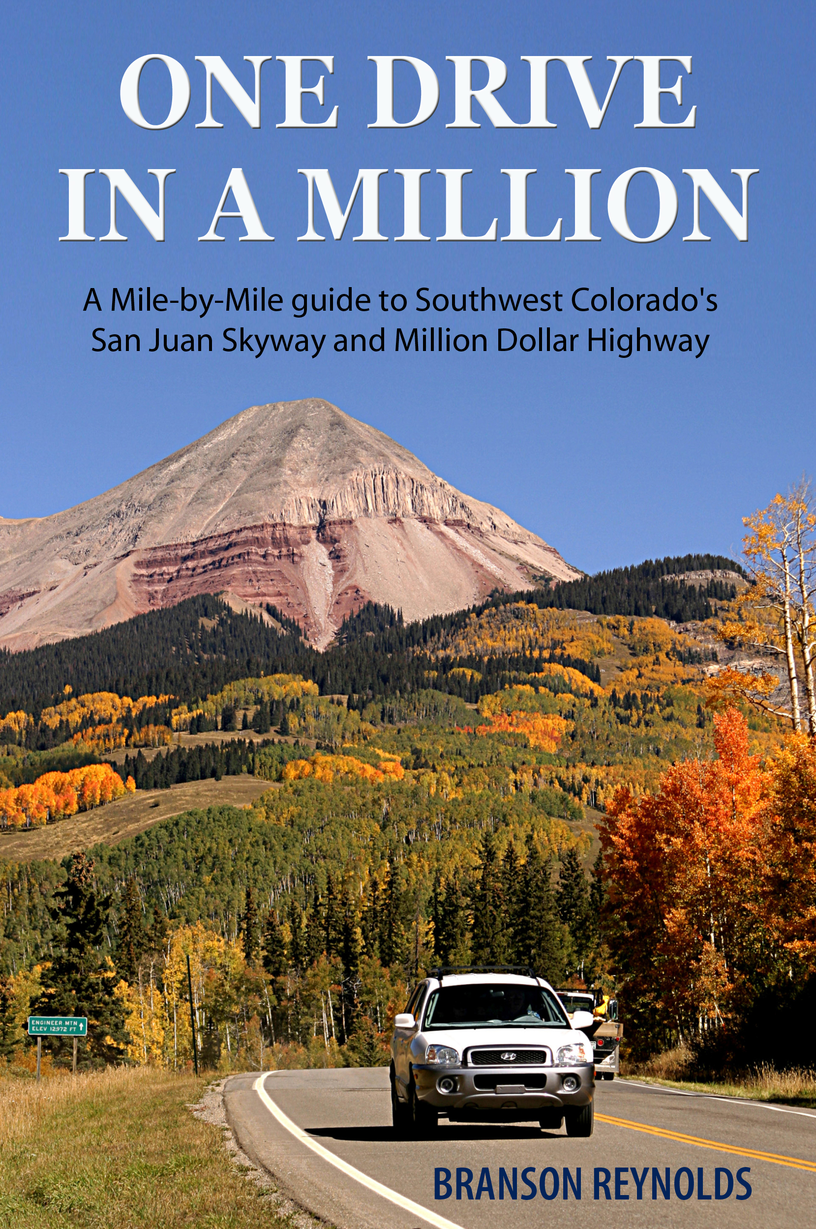
One of the most spectacular drives in North America, the San Juan Skyway is a 236 mile loop which winds through forests of aspen and pine, over high passes with stunning panoramic views of mountain ranges exceeding 14,000 feet in elevation, through historic mining towns which played important roles in the colorful history of Southwest Colorado, and past the World Heritage Site of Mesa Verde.
In 1988 this drive was designated as one of 54 National Scenic Byways, and was later chosen #1 of 10 to be designated as All American Roads for their natural beauty and historical significance. Along the way you may see black bear or mountain lions crossing the highway or elk and deer grazing in the meadows. A portion of this route includes the famous Million Dollar Highway which negotiates the awesome Uncompahgre Gorge, high in the Rocky Mountains between Silverton and Ouray, Colorado.
To the first Spanish explorers who visited this area, possibly as early as Coronado's expedition in 1540, they were known as the "Sierra Madres", the "Mother Mountains". Today the magnificent ranges of the La Platas, the Needles, the San Miguels, the Wilsons, and the Grenadiers, all merge before you into the heart of the San Juan Mountains. The majesty and beauty of these mountains is so great that they were originally proposed as the site for Rocky Mountain National Park, later located north of Denver. The number of private land holdings in the form of old mining claims prevented national park status, but the awesome beauty remains.
With time, the deserted towns and mines have become a part of the landscape. Animas Forks, Guston, Red Mountain City, Alta, the North Star, Silver Ledge and the Yankee Girl sit abandoned but full of nostalgia as they decay amidst some of the most stunning mountain scenery in North America.
Use this book as a guide to the natural and cultural history of the San Juans, and as a point-by-point reference to interesting sites and places of inspiring natural beauty that you will encounter along the Skyway. Also noted are National Forest campgrounds, intersecting roads, hiking trails, visitor’s centers, National Forest Service offices, and other useful information.
Travel the Skyway and experience what is truly "One Drive in a Million!
Using this Guide
As you travel the Skyway, mile-markers will serve as reference points. These markers are placed every mile between major highway junctions, the numbers getting larger going in one direction, and smaller going the other. The mileages are seen as white numbers against a green background located on metal posts along the highway.
The bold numbers in the guide represent the mile markers along the route. Locations in the guide are recorded to the nearest tenth of a mile beyond the last marker. Different odometers often give slightly different measurements and markers are also sometimes missing due to removal by snowplows, etc., so consider the mileages given between markers as close approximations.
Road Designations
The following road designations are used in the guide. They correspond with designations given on maps of the San Juan and Uncompahgre National Forests through which you will be traveling. Use your own judgment when traveling off of the Skyway, but remember it's easy to follow a road for a ways, and then discover you can't go forward and you can't turn around.
4WD-should not be attempted except in four-wheel drive, high-clearance vehicles.
Primitive-may be negotiable without 4WD or high-clearance vehicles, but not recommended.
Improved-graded dirt or gravel roads are generally suitable for all vehicles in dry weather. Watch out if it’s wet!
F.R. - Forest Road
N.F.S. - National Forest Service
C.R. - County Road
Конец ознакомительного фрагмента.
Текст предоставлен ООО «ЛитРес».
Прочитайте эту книгу целиком, купив полную легальную версию на ЛитРес.
Безопасно оплатить книгу можно банковской картой Visa, MasterCard, Maestro, со счета мобильного телефона, с платежного терминала, в салоне МТС или Связной, через PayPal, WebMoney, Яндекс.Деньги, QIWI Кошелек, бонусными картами или другим удобным Вам способом.